


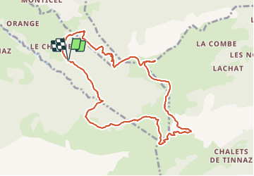
GLIERES / BORNES: LE CHENET - SUR COU - COL DU FREU - ROCHE PARNAL - COL DU CABLE - BALME

djeepee74
User


5h15
Difficulty : Difficult

FREE GPS app for hiking
 SityTrail
IGN / Geographical institutes
SityTrail Plus
The world is yours!
About
Trail Walking of 10.4 km to be discovered at Auvergne-Rhône-Alpes, Upper Savoy, La Roche-sur-Foron. This trail is proposed by djeepee74.
Description
BOUCLE... live du 20210530
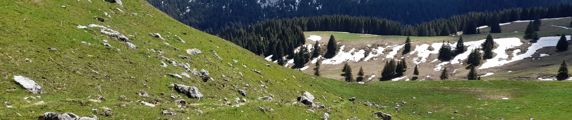
Encore quelques névés dans la montée du col du Freu.
Par contre, que des névés depuis le col du Freu jusqu'au niveau de l'arête sommitale menant à la Roche Parnal.
Enfin, un autre névé au tout début de la descente au col du câble.
Pour info: Dans le sens de la descente, le passage du câble peut "impressionner".
Photos


Positioning
Comments